Airspace, NOTAMs and VAC charts
Airspace
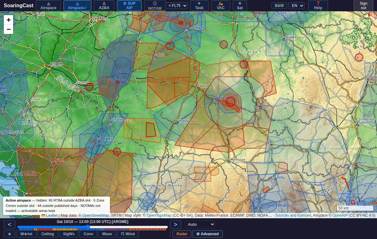
The EA button shows airspace. Clicking an area gives its name, class, limits and, when published, the frequency to call.
| Colour | Type |
|---|---|
| Bright red | P — prohibited area |
| Red-orange | R — restricted area |
| Orange, dashed | D — danger area |
| Dark blue | CTR |
| Blue | TMA |
| Green | Glider sector |
| Teal, dotted | FIS sector (SIV) |
EA✓ — active areas only
EA✓ hides the areas that are probably inactive at the time selected in the time bar: French military low-flying network outside its AZBA slots, the « Centre » area according to its calendar, NOTAM-activated areas with no current NOTAM, weekday areas at the weekend. Move the cursor to see tomorrow morning's or the weekend's airspace.
AZBA and AIP SUP
AZBA shows the French military low-flying network (red = active now). SUP AIP shows temporary areas published by supplements; over Germany, a panel lists the supplements in force.
NOTAM and VAC charts
NOTAM: link your Autorouter account
The NOTAM button shows the NOTAM active at the selected time, in France and neighbouring countries. They are fetched through your own autorouter.aero account (free): on the first click, follow the « Link my Autorouter account » panel. The link lasts one year.
The flight ceiling selector filters NOTAM by altitude. Abroad, set it to FL195 or « All FL » to see more of them. When a NOTAM activates a known area, the exact outline of that area is drawn (🎯 badge).
VAC charts
The VAC button shows airfields; a click opens the official VAC chart as a PDF. France, Spain, Belgium, Germany and Austria are covered. Switzerland and Italy require a linked Autorouter account. In Switzerland, only the airfields in the AIP are available.
Create an account to access the map, soundings and the dashboard.
Create an account